8010 Pike Rd. Gas Station (Amherstburg, Ontario)
Recollections (1990s, Early 2000s)
During the 1990s and early 2000s, I recall occasionally driving past a small gas station that was at 8010 Pike Rd., at the northeast corner of the intersection of Pike Rd. (County Rd. 18) and Howard Ave. (County Rd. 9), in the former Malden Township area of Amherstburg, Ontario.
I can’t remember the name/branding of the gas station. I don’t believe that it was one of the major corporate brands that were common in the area at the time (such as Shell, Esso, or Petro-Canada).
It was surrounded by a driveway area that connected to both Pike Rd. and Howard Ave.
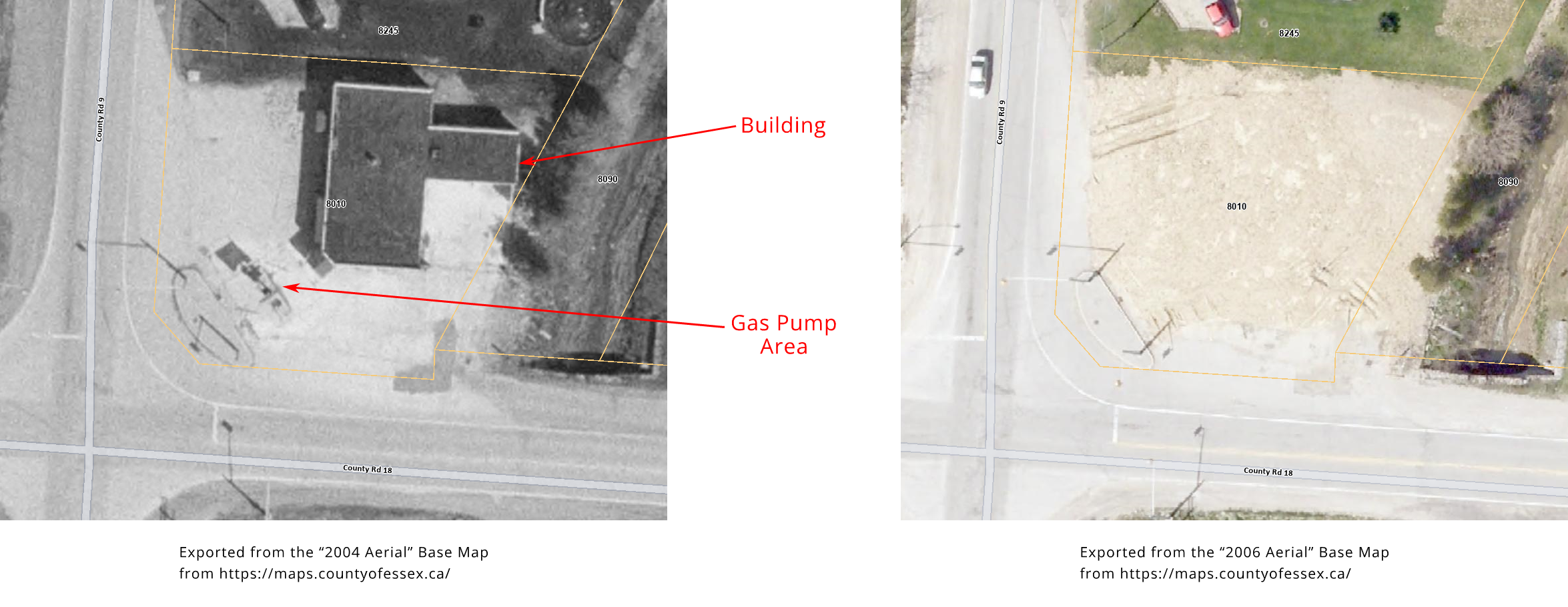
I believe the gas station had only one or possibly two gas pumps, positioned diagonally (running northwest to southeast), near the southwest corner of the property, close to the intersection. I don’t recall there being a canopy or other structure covering the pump area.
There was a building within the northeast area of the property, but I can’t recall if it had an auto service station, a convenience store, or anything like that. I don’t remember ever stopping at this gas station.
It was demolished sometime during the mid-2000s.
Other Information
The County of Essex “2004 Aerial” Base Map from https://maps.countyofessex.ca/ depicts the gas station, while the County of Essex “2006 Aerial” Base Map depicts the site after the gas station was demolished:
There are some notices about the property within the “Sales of Lands for Tax Arrears by Public Tender” section of The Ontario Gazette:
- Vol. 136-42; 2003-10-18; pg. 2622 (PDF pg. 10)
- Vol. 136-44; 2003-11-01; pg. 2655, 2656 (PDF pg. 7, 8)
Google Street View imagery from August 2009 shows the lot as being empty, with the structures there before having been demolished. It is mostly covered by grass, with some small remnants of the driveway still present. What appear to be some vertical metal poles or pipes coming out of the ground, perhaps vents for underground gas storage tanks, are visible near the southeast corner and the north side of the property.
The July 2025 Google Street View imagery shows the property looking much like it did in the August 2009 imagery. The vertical poles/pipes near the southeast corner and at the north end still appear to be present.